Stop Paying to Rediscover the Same Ground
The next infrastructure-data breakthrough may be better coordination, not better sensors. A USGS funding call and an award-winning Ontario utility show what that looks like, and the deadline for local governments is December 4.
By The Spatial Signal Editorial Board
· Week of October 26, 2026 · 7 min read
Listen · shortened audio edition
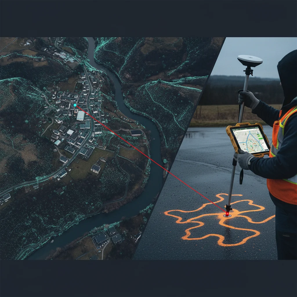
Image created by AI
Local governments have never had more ways to measure the physical world. Airborne lidar captures terrain in fine detail. Mobile mapping records entire streetscapes. Drones inspect bridges and construction sites. RTK GNSS puts a field measurement within centimeters. Computer vision pulls assets out of imagery.
Yet for most agencies, the core infrastructure-data problem has barely moved.
A road is surveyed for one project. A utility is located before excavation. A consultant flies lidar for a drainage study. A crew finds a water main several feet from where the GIS says it should be. Useful information gets created. Then it stays attached to the project, the ticket or the contractor that produced it.
The next real advance may have less to do with a new sensor than with something unglamorous: making every observation improve the permanent record.
Infrastructure data gains value when it is coordinated, maintained and reused, not just when it is captured more precisely.
Two developments this month show the idea from opposite ends. One is national: the U.S. Geological Survey’s fiscal year 2027 call for partners to co-fund elevation and hydrography data. The other is operational: an Ontario utility that turns every underground locate into a permanent GIS record.
Together, they make the same point. Infrastructure data gains value when it is coordinated, maintained and reused, not just when it is captured more precisely.
Capture Once. Use Many Times.
On October 15, USGS released its FY2027 Data Collaboration Announcement for the 3D Elevation Program (3DEP) and the 3D Hydrography Program (3DHP). These are the two halves of its 3D National Topography Model.
3DEP acquires high-resolution elevation data, mostly through airborne lidar. 3DHP derives a more detailed map of streams, rivers and other surface water from that elevation data.
The operating model matters as much as the data. Federal agencies, states, local governments, tribes, universities and private organizations can all apply, and every applicant must bring money:
USGS requires cost share and asks applicants to document each funding partner. By statute, USGS cannot pay more than half the cost of mapping done with states and municipalities. For 3DEP, USGS favors projects larger than 1,500 square miles, because bigger acquisitions cost less per unit. It will still consider smaller projects that cover a complete county or watershed, carry significant local cost share, or shrink because they overlap another submission.
The message is straightforward: don’t commission five separate elevation surveys when one coordinated acquisition can serve five agencies.
High-resolution terrain rarely has only one use. Lidar flown for flood modeling also supports road design, landslide and wildfire analysis, forestry, building extraction, drainage design and emergency response. Hydrography ignores municipal boundaries, so the watershed that floods one town often starts in another jurisdiction.
The window is short. Submissions are due by 5 p.m. Eastern on December 4. Agencies that want a USGS cost estimate must request it by November 13. Final selections may wait on the FY2027 federal budget, but an agency that doesn’t apply won’t be considered.
The Data You Already Paid For
Local geospatial programs live with a contradiction. Agencies spend real money collecting highly accurate information about the physical world. Then they don’t keep it in a form anyone can find, trust and reuse.
Take a county road project. Surveyors set control and capture terrain. Engineers build design surfaces. Contractors document construction, and inspectors record conditions. A drone may track progress. At closeout, the county receives PDFs, CAD files, point clouds, photos and as-builts.
Ten years later, another department needs to know exactly where a culvert, curb, retaining wall or conduit went in. The information probably still exists. Finding it is another matter. Knowing which version reflects what was actually built is harder still.
That gap, between having data and having usable infrastructure knowledge, is where the money leaks.
What If Every Utility Locate Improved the Map?
PUC Services, the city-owned utility in Sault Ste. Marie, Ontario, shows what the alternative can look like.
On October 2, PUC announced that it had won the Ontario Dig Authority’s 2026 Innovation in Dig Safety Award for integrating real-time kinematic (RTK) satellite positioning with its GIS. Crews use RTK- and Bluetooth-enabled locate devices that capture asset positions in the field and feed them directly into the utility’s GIS. PUC reports that positional variance dropped from several meters to about 2.5 centimeters.
Read that number carefully. It is the utility’s own figure. It describes how precisely the locate mark is positioned, not how precisely the locator found the buried line. Electromagnetic locating has its own horizontal and depth uncertainty, which depends on soil, depth, congestion and whether the asset can be traced at all. A centimeter-grade coordinate on top of a locate that is off by a foot is still off by a foot.
The more consequential idea is the workflow. A conventional locate answers one question: Where is the line, so we don’t hit it? PUC’s approach adds a second: Now that we know, why would we ever lose that? In the utility’s framing, each locate becomes a permanent, highly accurate data point the whole organization can reach.
One locate improves the next locate. One excavation improves the next design. That is a fundamentally different model from rebuilding an asset inventory every decade.
From Projects to Institutional Memory
Most cities don’t lack information. They suffer from fragmentation:
Engineering has one version, and public works has another. The GIS holds a generalized picture. Asset management holds maintenance history. Consultants keep the detailed project files. Field crews carry knowledge that never reaches a database.
As staff retire and contractors turn over, institutional knowledge disappears faster than the infrastructure does.
The opportunity is to treat every legitimate observation as a potential update to a persistent infrastructure record. That doesn’t mean dumping everything into one giant database. It means answering a few plain questions:
What is the authoritative record, and which system owns each type of information? How is new field information validated before it changes that record? How do GIS, engineering, asset-management and document systems exchange updates? Can a future employee find the data without knowing which project created it?
These questions are less exciting than AI, lidar or digital twins. They will decide whether those technologies deliver lasting value.
The Digital Twin Problem
Cities are increasingly offered platforms that combine GIS, BIM, reality capture, sensor feeds and asset data into digital twins. The temptation is to judge a twin by how detailed its 3D model looks. But a model that stops changing the day the project closes isn’t much of a twin.
A valve gets replaced. A fiber route moves. A curb ramp is rebuilt. A main exposed during excavation turns out to be two feet from its recorded position. Each event is new knowledge about the physical world.
The mature question isn’t How detailed is the model? It’s What process keeps the model true?
Procurement May Need to Change
Most contracts focus on the immediate deliverable: survey this corridor, inspect these bridges, map these utilities, build this pavement inventory. A data-conscious contract asks more:
Will observations be delivered in a structure that can update the existing GIS? What metadata and coordinate reference system are required? How will field changes be reconciled with existing records? Who owns derived data, and can other departments reuse it? Does the contractor return machine-readable data, or only a finished report? Will an inspection create a lasting asset record, or another PDF?
Those clauses decide whether a $500,000 collection effort produces $500,000 worth of information once, or keeps paying off for years. USGS already works this way: data acquired through its program must pass USGS validation, meet a published lidar specification and enter the public domain.
A Different Measure of ROI
Geospatial work is usually priced per road mile, per acre, per asset or per inspection. Coordination produces a different kind of return: avoided recollection.
The survey nobody had to commission, because a current one already existed. The hours a contractor didn’t spend searching drawings. The buried line a crew didn’t have to rediscover. The terrain an engineer already had before ordering more fieldwork. The flood extent an emergency manager could overlay on a trusted asset inventory the same afternoon.
These savings are hard to see because they are spread across departments and years. Collectively, they may be the largest untapped Return on Location an agency has.
The Infrastructure Intelligence Flywheel
Capture → Verify → Integrate → Share → Reuse → Improve.
A sensor captures something about the physical world. A person or automated process verifies it. It enters an authoritative system, where other departments can discover it. Future projects reuse it, and they generate new observations that improve the record again.
Once that loop runs, every project leaves government knowing a little more about its physical world than it knew before.
Ground Truth
The geospatial industry has spent decades getting better at capturing reality. The next challenge is making sure government stops paying to rediscover it.
USGS’s FY2027 call shows the economics at national scale: pool the needs, pool the money, acquire once. PUC shows the same principle at the scale of a single locate. Once you know where something is, that knowledge belongs in the permanent record, not in a closed ticket.
Lidar will get denser. Computer vision will get sharper. GNSS will get easier to use, and drones will fly more often. None of that creates infrastructure intelligence on its own. That happens only when organizations build the systems, standards and workflows that turn observations into shared institutional knowledge.
For local government, the next big geospatial breakthrough may be surprisingly simple:
Stop treating data collection as the end of the project.
Treat it as the beginning of the next decision.